


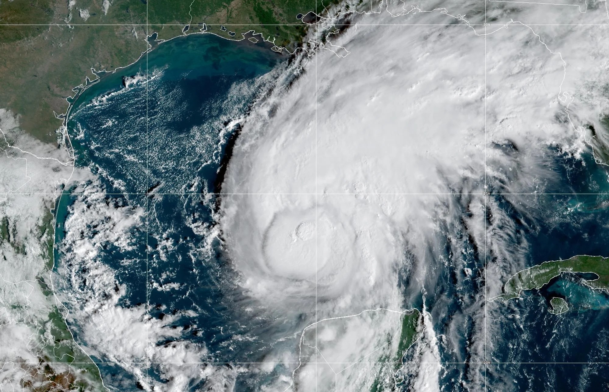
Hurricane Isaias is moving toward the Florida Panhandle, bringing dangerous winds, heavy rain and a serious risk of coastal flooding. The storm was downgraded to Category 2 at 8 p.m. Friday, but officials warned that severe weather could still affect several states.
The hurricane is expected to make landfall east of Pensacola on Friday night. It is then forecast to move inland overnight, bringing more rain and strong winds to parts of the southeastern United States.
Coastal communities are facing a major threat from rising water. A storm surge warning covers areas from the mouth of the Mississippi River to the Suwannee River in Florida. Life-threatening flooding is possible in low-lying coastal areas.
The highest storm surge could reach 6 to 9 feet between the Alabama-Florida border and Grayton Beach in Florida. Areas from Indian Pass to the Steinhatchee River could see water rise by 4 to 6 feet. A surge of 1 to 3 feet is also possible as far south as Pinellas County.
Residents in affected areas should follow local warnings and be ready to move to safer ground if officials issue evacuation orders.
Hurricane warnings are in effect from Ocean Springs, Mississippi, to the boundary between Bay and Gulf counties in Florida. Tropical storm warnings extend east toward Tallahassee and north toward Birmingham, Alabama.
These warnings mean dangerous weather could affect a wide area as the storm moves inland.
Strong winds may damage trees, power lines and buildings. Heavy rain could also make roads unsafe and disrupt travel. People living near the coast face extra risks from high water and powerful waves.
Officials are urging residents to take the warnings seriously, even though Isaias has weakened to a Category 2 storm.
Rainfall is expected to create another serious threat through the weekend.
Forecasts call for 4 to 8 inches of rain across southern Alabama, the Florida Panhandle, the Big Bend region and southwest Georgia. Some locations could receive as much as 12 inches.
Such heavy rainfall can quickly overwhelm drainage systems and flood streets, homes and businesses. Rivers and streams may also rise as water flows into already wet areas.
Flash flooding is possible, especially in low-lying neighborhoods and places where water cannot drain quickly. Significant river flooding may also develop in some communities.
Drivers should avoid flooded roads. Even shallow water can hide damaged road surfaces or carry vehicles away from the road.
The threat of tornadoes is also increasing as Isaias approaches land.
A tornado threat developed Friday evening across coastal Alabama, the Florida Panhandle and far southwest Georgia. The risk is expected to spread into other parts of Alabama, Georgia and the Carolinas on Saturday.
Tornadoes can develop quickly during tropical storms and hurricanes. They may form even when conditions outside appear less severe.
Residents should monitor local weather alerts and know where to shelter. An interior room on the lowest floor of a sturdy building is often the safest option. People should stay away from windows and seek shelter at once if a tornado warning is issued.
Southwest Florida may avoid the storm’s strongest impacts, but beach and boating hazards remain a concern.
A high risk of rip currents is expected at local beaches Friday night and Saturday. These powerful currents can pull swimmers away from shore and into deeper water. Even strong swimmers can struggle to escape them.
High waves and unusually high tides may also cause coastal flooding along Southwest Florida’s beaches.
Gulf waters are expected to remain rough on Saturday, with waves reaching 4 to 7 feet about 20 miles offshore. Small Craft Advisories are in effect, warning boaters of unsafe conditions.
Conditions are forecast to improve on Sunday, when wave heights may fall to 2 to 4 feet. Sunday is expected to offer better boating conditions than Saturday, although beachgoers should still check local warnings before entering the water.
Hurricane Isaias poses several risks across the Gulf Coast and nearby states. Storm surge, heavy rainfall, strong winds and possible tornadoes could all cause damage as the system moves inland.
Residents should keep track of official weather updates, prepare for possible power outages and avoid unnecessary travel during severe conditions.
The storm’s weakening does not remove the danger. Coastal flooding and heavy rain can remain life-threatening even after a hurricane loses strength.
As Isaias moves across the region, local conditions may change quickly. Following emergency instructions and staying away from dangerous water will be vital to protecting lives through the weekend.

